Key challenges of the NZ Space Challenge
identify cracks in ice and have technology to avoid running into these or other obstacles whilst travelling from Mc Murdo Bay to the South Pole in Antarctica

Core solution principles
before/ during trip sensing, sensor fusion of track unevenness detection technology
Before Trip
- use satellite IR (1 km) and SAR data (30 m) to map trip around obstacles and cracks

cracks will have a different IR footprint than solid ice

During Trip
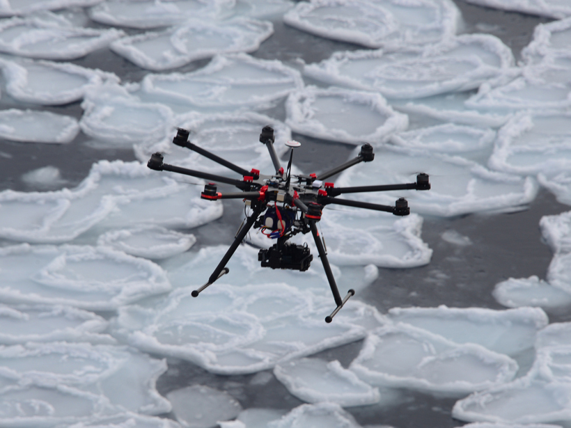
- use live drone based visual crack monitoring (computer vision from stereo camera and real-time 3D point cloud reconstruction) to avoid major cracks visible from above
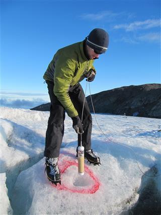
- use vehicle based wireless geophone to continuously sense if & where cracks are ahead (sound travels at 4km/s in ice vs. 300m/s in air)
- ground penetrating radar to scan the surface under the convoy from a remote controlled lead vehicle
- use object avoidance AV guidance system to navigate around obstacles safely

Post trip
- evaluate SAR/ IR satellite data and develop/improve ice surface opening/ unevenness models
- use in-situ data collected as early warning system for next trip
Cost benefit considerations
We think we can integrate existing componentry, develop required analysis algorithms and offer a solution under USD 25,000 which works in Antarctica and potentially in space.
- drone with stereo camera technology and computer vision analysis costs around $5,000 per device
- low-cost geophone will cost about USD 1,000
- acquiring and analyzing SAR/ IR satellite data before the trip is dependent on our collaboration partners. If we work with NOAA or similar, we potentially get the raw data for free. Once the analysis models are built, it is just a number crunching exercise which can be automated. We will use the collected data for training our AI Deep Learning algorithms to build/ improve an early warning ice crack model. The same could be envisaged for a planet, once sufficient training data is available.

Fig: low-cost energy efficient geophone, Dai (2017)
References/ Background
- Our Presentation, Financial Guesstimates and compiled video
- Dai – geophone design
- Klette & Chien – computer vision models
- NN – SAR/ IR satellite data analysis
- Dave Cist – Ground Penetrating Radar


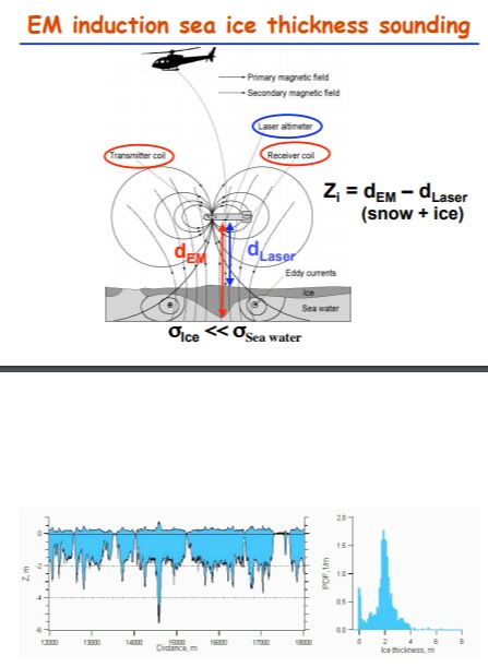
Fig: AWI – Lemke: Sea Ice remote sensing
