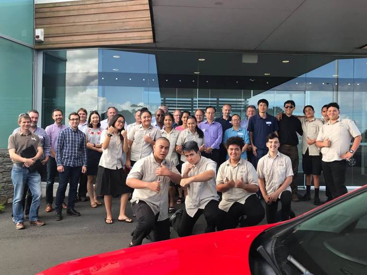
On 22. March 2018, NIC hosted the First Smart Transport Technology Demo Day in Northland. We had an exciting line up of speakers and stakeholders. An impressive crowd made their way to Marsden Point. Visitors included two Russian & Chinese researchers from German Aerospace, Fonterra, Fulton Hogan, Whangarei District Council, Auckland University of Technology, Short Cut Media (leaders in computer vision technology and working from a yacht currently in the town basin) and a dynamic group of students from the local Te Kapehu Whetu Maori Charter School.


We had the following presenters:
- Dr. Adrian Dorrington, ChronOptics – Time of Flight applications for self-driving vehicles
- Dr Sergey Zuev, DLR – update on Northland research and location based solutions
- David Inggs, Rocos – remotely controlled swarms of robots/ a simulation
- Derrick Williams, Opus: Otaika Valley Road – Vision for the first rural smart road in NZ
- Professor Dr. Peter Chong, AUT – V2x and how vehicles will communicate in the future
- Martin Knoche, N3T – Pothole Finder, Driver Assistant Systems for Trucks
Here is a brief break-down of the demonstrations from the Demo Day.
ChronOptics has developed a leading edge time of flight camera system.

It is currently used to detect object in a manufacturing environment. But the founder Dr Adrian Dorrington, a former senior lecturer at Waikato University, is working on motion capture for the film industry, potential application in the automotive industry as well as other exciting use cases.

German Aerospace Agency (DLR) and Intelligent Positioning System (IPS)
The Northland Innovation Centre (NIC) which promotes leading edge research into Northland is hosting two researchers from the German Aereospace Agency (DLR) the last week of March. The two researchers’ Dr Sergey Zuev and Dr Hongmou Zhang have developed the Intelligent Positioning System (IPS). IPS allows vehicles to navigate to less than a centimeter accuracy. This is an important feature on the way to driver assistance and self-driving vehicles.
")
")
The researchers mapped Otaika Valley Road, Marden City and the unsealed Wright Road. This high resolution 3D map will be used by NIC/ N3T to assist truck drivers and other road users to drive safely to the conditions. Together with smart weather stations which detect changing weather, visibility and road slipperiness conditions, this system sends early warning alerts to drivers. This can include fog warnings, heavy rain or information on slippery roads like “summer ice”. Knowing exactly where a vehicle is, will allow existing systems like lane keeping, adaptive cruise control to help the driver to drive more safely.
With about one fatal crash every day in New Zealand and over 1.3 million road deaths worldwide, this system will help to save life’s. Otaiaka Valley Road had over 80 crashes including three fatal accidents since 2007. NIC with its partners like ZF promotes the Vision Zero. This means no crashes and zero emissions by 2025.

The technology & algorithms the researchers from Germany tested this week in Northland will be used to navigate the Rover robot on Mars. It uses two stereo cameras and an inertial measurement unit (IMU). Unlike GPS which can only navigate to 5-10 meters accuracy, the IPS systems can navigate to under a centimeter. All this technology is aimed to make Northland/ New Zealand roads safer.

Fig: Intelligent Positioning System for automotive industry
About DLR
The German Aerospace Centre (DLR) has over 8,000 staff, 20 research facilities and a budget of $3.9 billion. DLR researches in aerospace, energy and transport. It has been involved with the Mars mission via the European Space Agency. DLR is one of the leading research institutes on self-driving vehicles in the world. The DLR researchers who worked in Northland in March come from the Optical Sensor Institute in Berlin.
Rocos is a cloud based application to control many robots like drones, automated farming equipment and potentially other fleet of robots. The founders Dave Inggs and Richard Stinear showed a demo on how several remotely controlled drones can assist in search and rescue efforts and safe lives.

Rocos is an early stage start-up based in the Auckland Flux Accelerator.

AUT Professor Peter Chong gave a very engaging presentation on V2x. This is technology to make a vehicle communicate with anything.

He demonstrated a few trial to use V2V to communicate a video stream from one car, via a second car to a third car using Wifi protocol 802.11.p. This protocol is an extension of the well known Wifi product family you will be using regularly in your home or at work. NIC plans to work with AUT further on combining our AV work with their V2x research. NIC already engages several of AUT’s top students & researchers in our collaboration effort.
N3T (Northland Transport Technology Testbed) is a subsidiary of NIC and works on making Northland/ NZ/ Global roads safer. N3T presented on its current project to map the status of the surface of sealed and unsealed roads in Northland. Since Christmas 2017 every week trucks fitted with N3T’s technology collect over 3,000 km of data on Northland roads. This data is used to detect and map potholes. Potholes cause crashes, deteriorate vehicles by increased tire punctures and damage to the vehicle. Major truck operators spent over $2,500 per truck per year more on repairs and maintenance than in other regions of New Zealand. This is due to the bad roads in Northland. Potholes also cost a lot of money to fix. It is a bit like with your teeth: if you find a hole, get it fixed quickly and it causes less grief and is cheaper than getting an expensive inlay or bridge fitted. Same with potholes, find them early, get them fixed and don’t incur big bill to resurface the roads at tens of thousands of dollars per km.
The N3T solution has been a collaborative effort by N3T, Bert van den Berg from Whau Valley based CruzPro, AUT lecturer Johnny Chien and Jakob Thumm from KIT. We are working to improve the current prototype further.


N3T works with road maintenance contractors, roading authorities and global researchers to develop an affordable, easy to use technology which can map road unevenness and the changes in the road infrastructure by putting a small box on vehicles travelling the same roads every day, as part of their jobs. This could be logging trucks, milk trucks, petroleum trucks, mail delivery couriers or others.
This technology is part of N3T’s platform strategy to develop safer roads solutions and prepare Northland for self-driving vehicles.
Check out a short video on the state of the art of self-driving trucks.
NIC/ TKP/Virginia based Cville Machine announced that they plan to establish a tech accelerator in Northland. This supports NIC’s strategy to grow digital tech talent & businesses in Northland.
If you have any comments or questions, please contact us.
